Monthly Archives: June 2015

Sufferin’ Summits Hill #5–Summit South Complex

#4 Zoo Hill Complex <= #5 Summit South Complex => #6 Summit from the north

As we continue to work our way to the west, our next hill is the very uncreatively-named “Summit”. We will continue the theme of climbing the same damn hill three times, but there will be a nice descent when we’re finished.

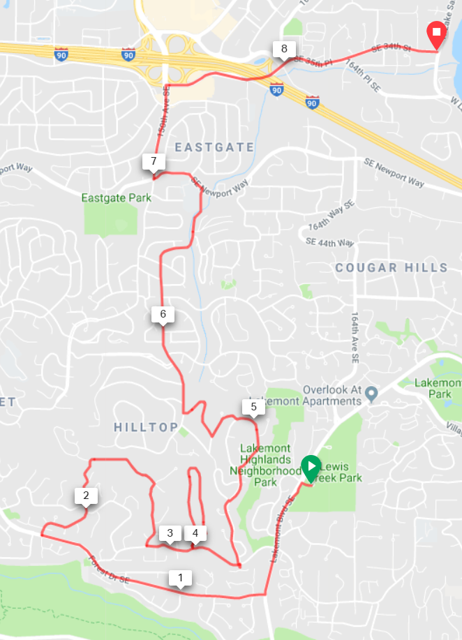
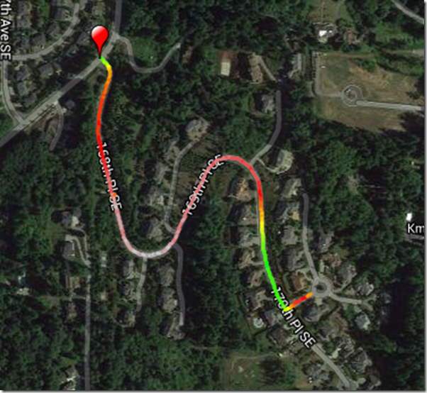
Turning left out of Lewis Creek Part, we descend for about half a mile and turn right on Forest Drive. This road is a great descent, but pay attention; we need to turn right after 1 mile onto 142nd Ave SE. Aka “The Widowmaker”. The road will wind around as it climbs and oscillates from steep to really damn steep. It will eventually turn right and the gradient will ease. Continue straight until the road ends, take the connector path, then turn right at your next opportunity and descend back down. At the stop sign, turn left.

Turn left into “West Summit”, and climb straight up, follow the road as it turns right and loops back down. Turn left and exit down the way we came in, and turn left at the entrance.

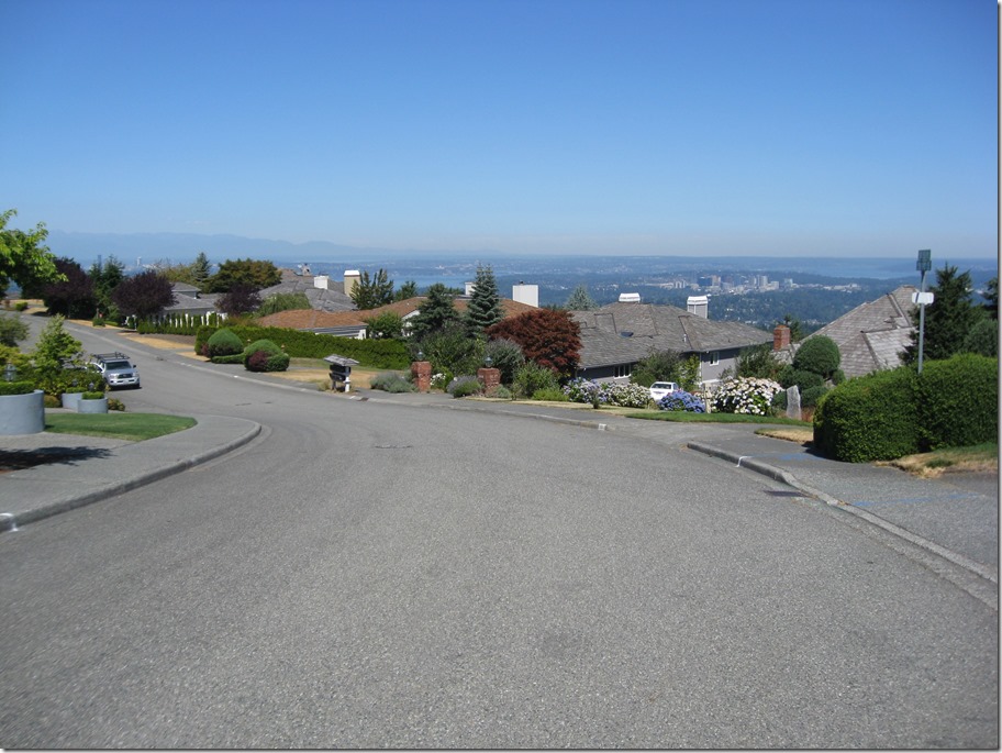
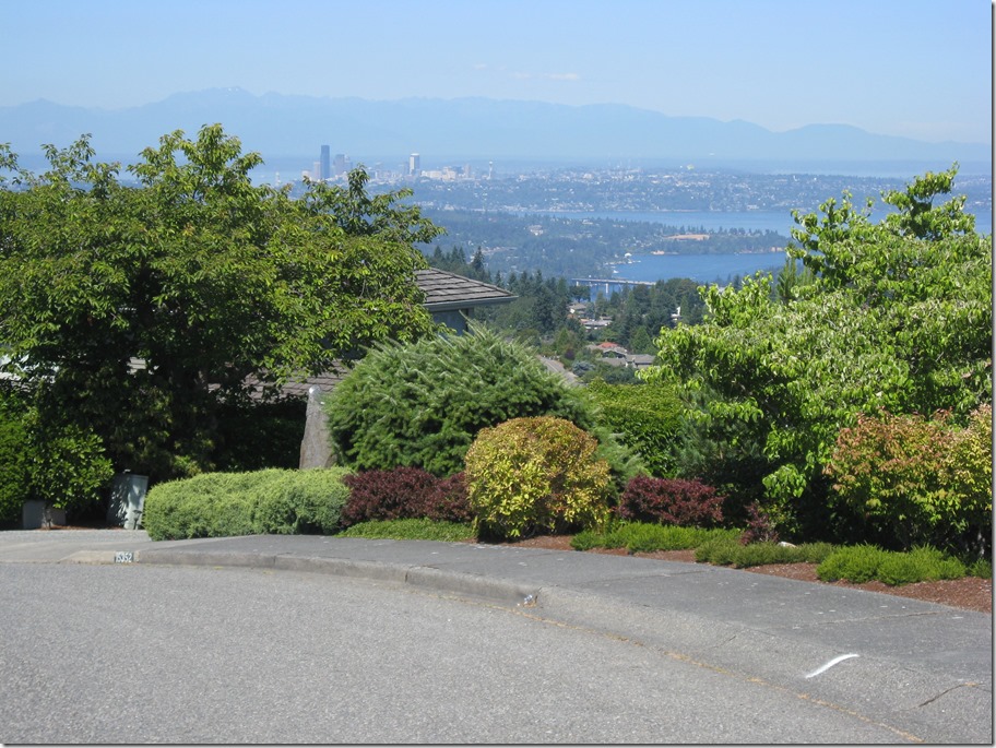
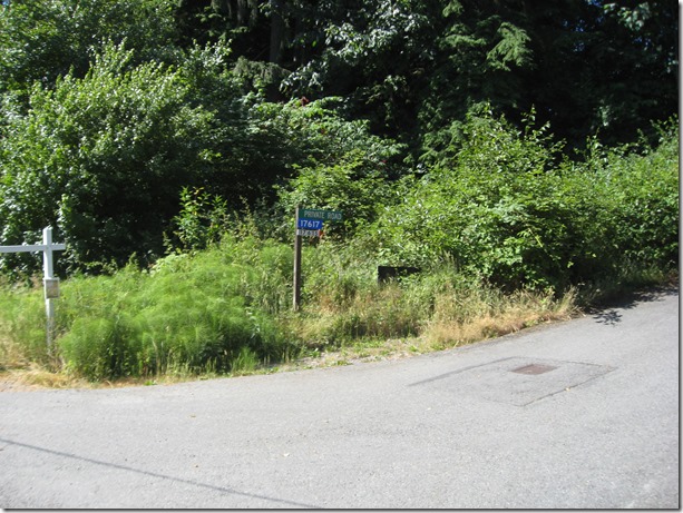
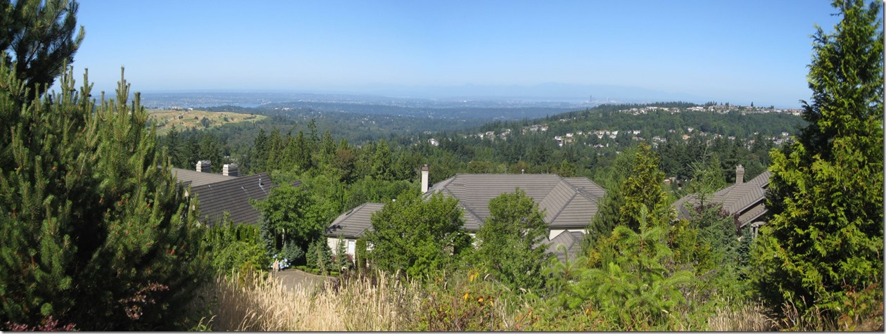
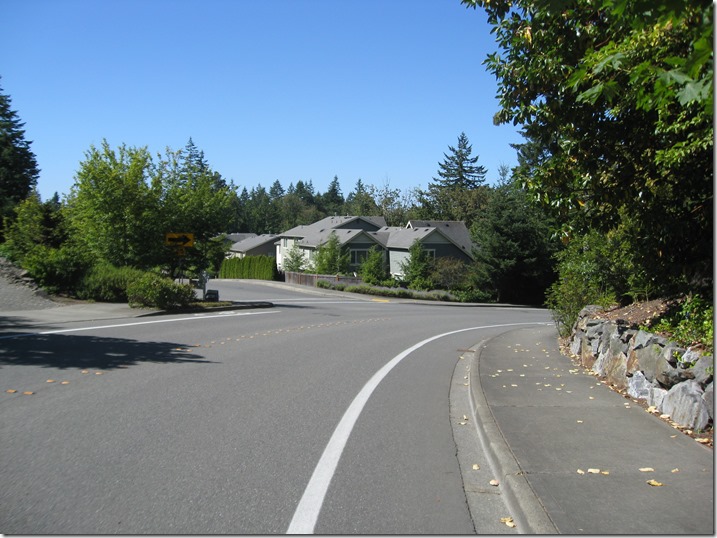
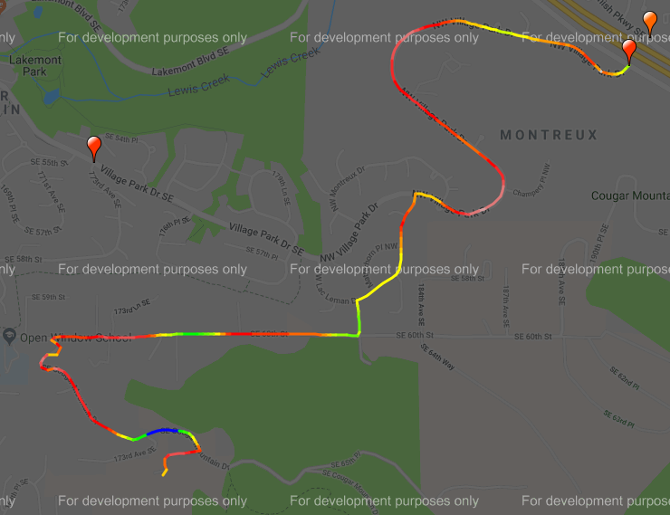
After a short steep section, turn left at the entrance shack into “Summit”. This road is undulating; hard/easier, harder/easier, hardest/easier. When you hit the stop sign, turn right and climb up until the road crests. There are some decent views to the north here, but they aren’t as good as Pinacles or Belvedere. Ho Hum.

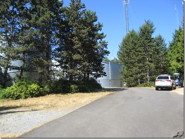
IMG_6920IMG_6921

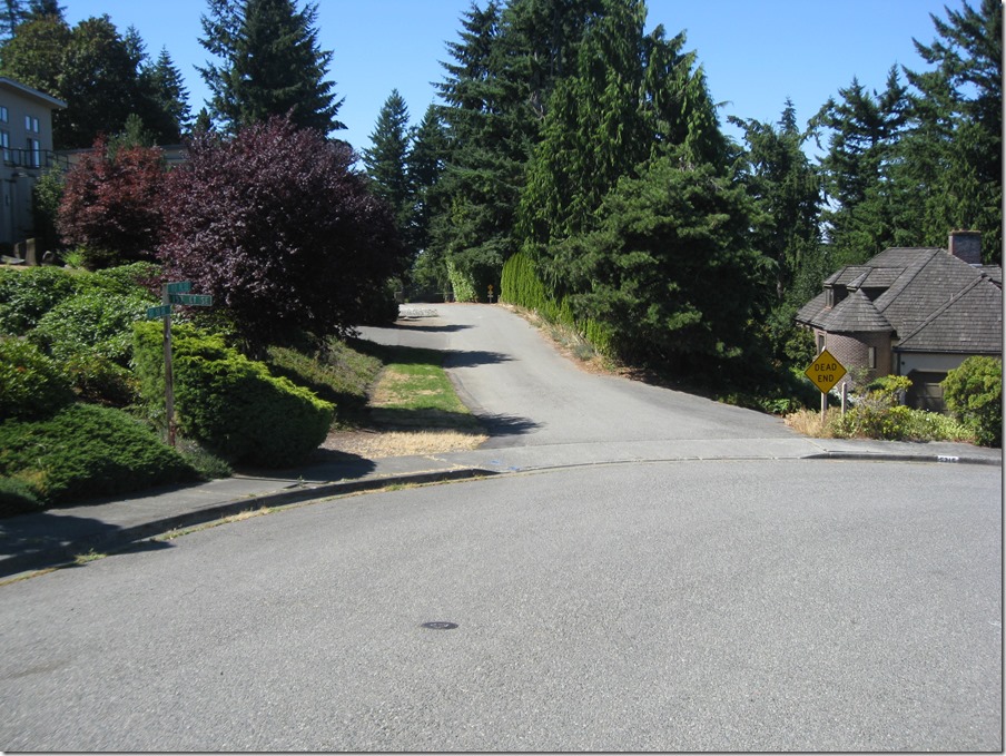
Continue straight and take the first right, then look for a “Dead end” emergency vehicle access road on the left.

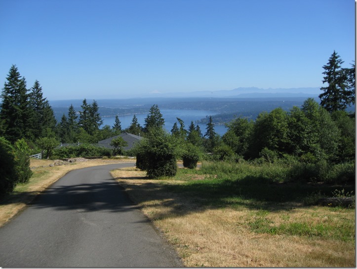
IMG_6922

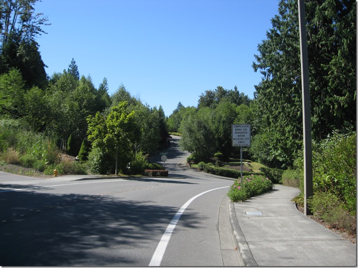
This will take you to a gate that you’ll need to carry your bike around. Turn right at the next two intersections and you’ll be on a nice straight descent to the north. The Sufferin’ Summits road crews have been hard at work repaving this section, so the pavement is exquisite. You will ride the road all the way down to the stop sign on Newport; turn left and then take a right at the light on 148th. At the next stoplight, you’ll be in Eastgate, with a gas station (food & water) on the right. There’s also a Safeway in the same complex. You will definitely want food and water for the next section.

Turn right onto 148th (well, 150th now), and immediately turn right on SE 37th. This will take you under the freeway, through a stop sign , and then right again onto 164th Pl SE, which takes you all the way down to the shores of Lake Sammamish, the lowest point of the ride and the perfect spot to start our next climb.

1105’, 8.6 miles.

image

image imageimage


Sufferin’ Summit Hill #4 – Zoo Hill Complex

#3 Talus <- #4 Zoo Hill Complex –> #5 Summit South Complex

This section has evolved over the years.

Initially, it climbed the lower part of the Zoo Hill climb and then hopped over to the top of Montreux to grab the exquisitely painful Montreux->Zoo connector. Which was nice and painful, but it really ruined the flow of the ride and was confusing if you didn’t know the route, so nowadays we just do the classic climb, which is more unrelenting and plenty painful.

The entrance is easy to find; there is a “Zoo” sign on the right.

IMG_6905

and another zoo sign on the left:
IMG_6906

We turn left and immediately hit a steep pitch. After a bit of back and forth and steeper and less steep sections, we near the hairpin. If you look closely, you will see that the sign says it is a 15 MPH turn, which is pretty tight.  And you can see why I call the climb “delightful”.

IMG_6907

We continue on a bit, and the 15 MPH turn morphs into a 10 MPH turn.


IMG_6909

It doesn’t show in the picture, but the inside of the hairpin is really, really steep. Like 20%+ steep. It is also a bit torn up from car traffic. You will be much happier if you stay out near the center line, where the gradient is less and the pavement is a bit better.

Soon after the hairpin, the gradient eases, the lower part of the Zoo ends, and we turn right onto the middle section. This is a section of straight road with a set of rollers. A seemingly endless set of rollers.

As soon as it flattens, we take an immediate left to do the top section. When this road flattens out and starts to descend, keep going and take the first driveway to the right:

IMG_6882

This will take you all the way up to water towers at the top of the hill:

IMG_6883

Turn around, and it looks like this. You can just barely make out Mt. Baker on the horizon.

IMG_6884

Descend back down to the main road, turn left, and start the descent. After a short straight section, the road turns right, and we continue straight (ie turn left) into Pinacles:

IMG_6885

Unfortunately you can’t see the sign when descending. This takes us up a steep climb that flattens. Turn left into the cul-de-sac to get the last little bit of elevation. On the way down, stop to take in one of the best views of the day, looking southwest:

IMG_6887_stitch

On the left, Newcastle Golf Course with Lake Washington beyond, to the right is “Summit” with Seattle peaking in the distance.

Once we hit the main road again, we turn left and again start looking for a left turn, this time on 166th Way.

IMG_6889

This will go straight for a while, then we will turn left to climb up through Belvedere:

This is the last climb of the complex. This takes us to pretty much the same height as Pinacles, just a bit to the south.

IMG_6891_stitch

To the left there’s a pocket view of Lake Washington with Newport Golf Course in the middle and the lake beyond, and then Seattle in the distance on the right. Plus, some hay bales and a very pretty truck.

Finally, we descend down, once again turn left, and descend until we hit Lakemont. Turn right and a short climb brings us to Lewis Creek Park, which has water and bathrooms.

That section was 10.4 miles and a healthy 2030’ of elevation gain.

image

Zoo Hill

image

Pinnacles

image

Belvedere

image


Sufferin’ Summits Hill #3–Talus

(2) Squak     <=  (3) Talus    => (4) Zoo Hill Complex

Talus is a development on the east side of Cougar mountain, named after a bone in the ankle. Or maybe a rock deposit on the hill. At least it’s not “Summer Bluff”, or “Raccoon Forest” (thanks to the excellent Real Estate Subdivision Name Generator for those), or my development’s name, “Malibu Vista”.

Anyway, Talus is a climb that I’d never done until recently, because it was a one-road “up and back down” sort of climb. At least, that’s what I thought, but a bit more research and a test ride showed that I was mistaken, and there’s a nice hidden climb there.

After leaving the starting point, we turn left onto Renton-Issaquah road, and then turn right onto James Bush Rd. The sign says, “no Talus access”, but that’s just for cars, not for us. Gear down before you turn. The road immediately kicks up, climbs a bit, and then kicks up some more as it narrows to a single lane climbing up through the trees. Make sure to start this climb slowly; if you hit it too hard it will be difficult to recover. Please pay attention so that you don’t slow down other cyclists on this section.

Eventually, you’ll come to a gate and the climb will spit you out into the development. Turn right and continue to climb, then bear right towards the park and take the 20% cut-through to keep climbing. This will spit you out again on the road, and you can continue to climb until you top out.

We then traverse to the south to do the second half of the climb, which works its way up to recent higher development. Then there’s a descent down the south entrance. .

The overall Talus climb is about 750’.

The descent has a stoplight at the bottom, so watch your speed. We turn left and ride towards the park.

image

The gradients here feel pretty close to me.

image


Sufferin’ Summits Hill #2–Squak

(1) Grand Ridge <=      (2) Squak    => (3) Talus

This one will be of little surprise to anyone. The mountain known as “Squak” is an obvious choice, and since we are coming from the east, there isn’t even any suspense about which side we will climb. This is conveniently the harder way up.

I first climbed this back in 2006, as the last climb the Seattle Randonneur’s “Mountain Populaire”, a 100 kilometer ride that started on Zoo hill and finished on the first half of this climb up Squak. At the time, that was hardest ride that I had ever done. Little did I know that a few years later I would be putting together a ride that was worse.

After going through Issaquah on Sunset, we continue straight as the road turns into Mountain Park Blvd. The first section is a series of rollers, but not in the usual “up and down” sense of rollers; these are of the “up and upper” variety. Just as the road flattens out, we turn left on Mountainside Drive to continue the climb. Don’t worry if it looks flat; it will kick up steeply after a short bit.  After a bit, we leave the houses behind and hit the upper section, a switchbacky road. Eventually, we hit a stop sign at the entrance to the Forest Rim Development. Turn right or left, and you will top out a full 1000’ from the start.

It is your choice. Just as doing this stupid ride was your choice.

The descent of the top section is the same way we came up. The pavement is in good shape on the upper half but there is one very tight turn, so it’s essential to control your speed well. When we reach the intersection, we turn left, descend 0.7 miles, and turn left again where the arterial turns on Mt. Olympus Drive (this is easy to miss). This is a fun curvy section that will take us down to the bottom, but note that there is a really steep section with a stoplight at the bottom, so, once again, watch your speed.

This takes us all the way down to the base, where we come out right next to our starting point. Bathrooms and water are available in the park on the left before the light, and I recommend filling up; there are two hills before the next opportunity.

Here’s the map. Click to view online.

image

And here’s the color-coded map for the climb. Gradients are estimated; your gradient experience will vary. See a doctor for climbs lasting longer than 4 hours.

Click to go to the BicycleClimbs.com source page.

image