Monthly Archives: July 2015

Sufferin’ Summits Hill #8: Somerset & Traverse

Highland/Somerset <= Somerset & Traverse => (mostly) down to the finish!

Breaking news!

For many years, I thought that “Somerset” meant climbing up the road we just descended, because that was the only route I had ridden. At about 450’ and a nice section of about 16%, this is certainly a challenge. And then, one day, I was looking at maps (because I lead a Tue/Thu night ride and like new routes), and I realized that there was a route from the west that I had never heard about that starts a bit lower down.

So, I went and rode it, and found out why I had never heard about it.

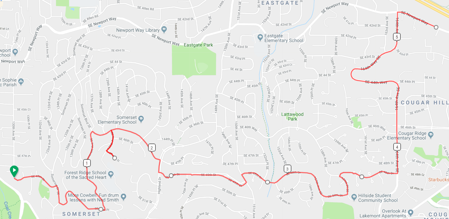
The route is mostly easy to follow, though there are a couple of places where you need to pay attention. Start up the first pitch, and when the road ends, turn right. Take the first left and continue climbing, following the road as it curves around. After the big curve, you are looking for the first turn to the left – 136th Pl NE. If you miss it and you run into Highlands drive, turn around and come back.

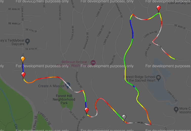
After the turn, there is about a half mile section that will end at Somerset Blvd – the one we descended down earlier. We turn right, then right again on 139th Ave, and a final left on SE 47th. This section is easy to navigate; just keep turning on the streets that go up. At the top, turn around, and enjoy the last great view of the ride.  We don’t have the altitude we had at the earlier climbs, but we are closer in and there is nothing in front to block our view.

Image result for view from top of somerset bellevue

image

Now, it’s time to traverse to the east towards the finish.

We descend back down to Somerset Blvd and turn right. The first pitch is a steep descent with a stop sign at the bottom. Turn right, and then take the first left on SE 49th. Continue straight until it ends at 151st Avenue, which we travelled earlier on the Summit climbs. Turn left and take the first right on SE 48th. This will curve around and change names a couple of times, and finally end at 159th Pl SE.

Turn left, and then take the first right on SE 48th drive. This will take you to a short bike/ped section and then a steep descent down to 164th with the usual stop sign at the bottom. Turn left on 164th, descend down to Newport, and turn right. This will take you all the back to the starting line.

4.6 miles, 861’

image


Sufferin’ Summits: Hill #7–Highland/Somerset

#6 Summit North <= Highland/Somerset => #8 Somerset and Traverse

This section is mostly a portage from our last descent to where we will start section #8, but there is no reason that a portage can’t be “fun”.

After turning right at the bottom of the summit descent and then right at the next stop sign, we find ourselves back on Forest Drive. After just over half a mile, we turn right on Highland Drive. This climb goes steep/flat/steep/downhill/steep/flat, and will take us into a notch between Somerset hill to the west and Summit to the east. After a short 1/4 mile rest, we turn left on Somerset Blvd, hit the crest, and then continue down to the North. Nice views here, but at 15-16% you will be needing to use your brakes.

We eventually come to an exit where you can see a traffic light to the left. Turn left to the light, and then turn left to get onto Newport Way. Once again, we have a descent that we are going to be turning off of, so watch your speed. After half a mile on Newport, the road will curve right but we turn left on 130th Place SE, then left on 130th Ave SE. Continue straight on this road; you’ll know when you’ve reached the start of the next hill.

3.9 miles, 359’ of climbing

image

image


Sufferin’ Summits Hill #6 – The Summit Strikes Back: from the north

#5 Summit South <= #6 Summit North => #7 Highland/Somerset

*************************************

Note: I hadn’t ridden the section on Squak for a while when I wrote it. I rode it last weekend and re-wrote that section. You should go read it now so that you understand what the descent is going to be like and don’t ride your bike off the road.

*************************************

After the nice descent down from Summit and replenishing our food and water supplies, we’re going head west and do something a little different and easier.

Ha ha! I make joke! We’re actually going to climb right back up the hill that we just came down. This is a climb I do fairly often; it’s near my house, the roads are good, traffic is light, and there’s a surprising amount of up. And there are a few different routes to take.

We, of course, are going to take the hardest way up. It’s a bit convoluted, so you’ll need to pay attention.

Starting way down near the water, we turn right on East Lake Sammamish, and then turn right into the Forty-One Point Five development. Follow the road as it turns right and then – you guessed it – starts going up steeply. After a couple of left turns, it will top out. As the road turns left, look for a path on the right; I *highly* suggest getting off your bike and walking it as there’s a tight turn and it can be mossy. Turn left on the path and descend down to the bridge, and ride over it the other side, and turn right on Newport Way.

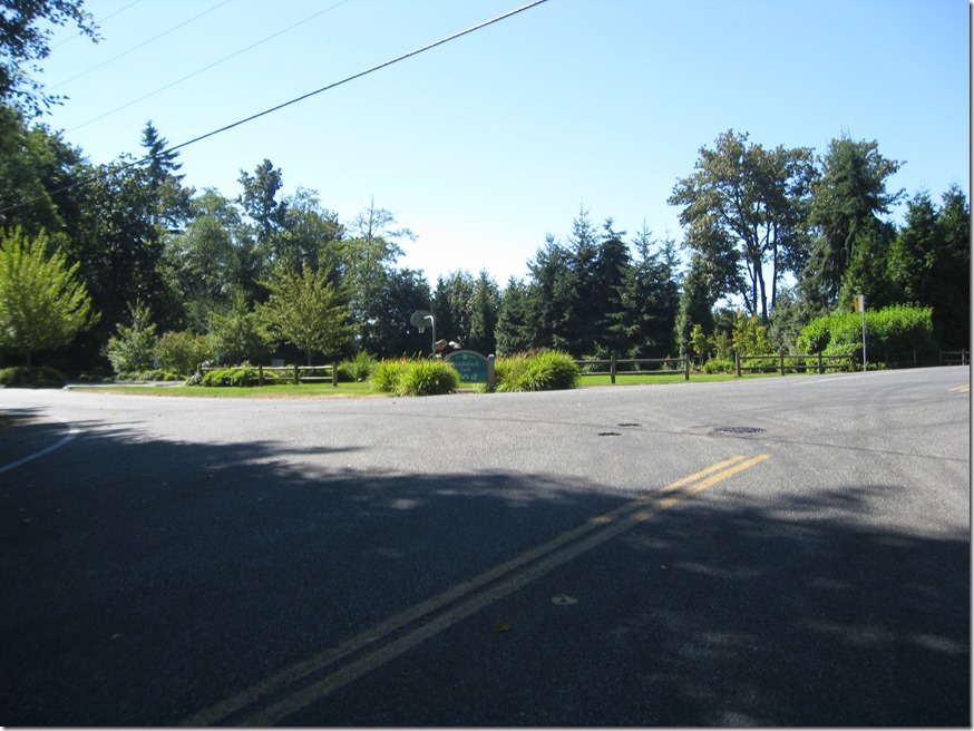
After a easy 1.2 mile climb – enjoy it because it’s pretty much the only one all day – the road flattens, and we turn left on 155th Pl SE. Just look for the very steep hill. Follow the road as it winds up; when it flattens, turn left, and when it flattens again, turn right. When the road ends at SE 46th, we turn right. That road ends on 150th, where we turn left and climb up on the road we descended recently. Keep climbing until you reach the park:

IMG_6913

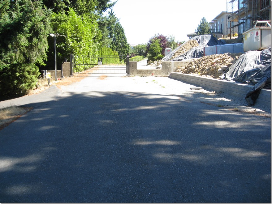
and then follow the road to the left. Take the first left, and that road will lead you back to the gate you climbed over earlier.

IMG_6916

Cross it again. Turn right when you hit the main road, work your way around, and descend down the south side. Watch your speed as there is a stop sign at the bottom.

Turn right at the bottom, and follow the road down until you hit Forest Drive.

It isn’t the most continuous climb around, but this section nets us 1100’ over 5.9 miles. That is our 4th climb over 1000’ in elevation gain.

Route and climb info. Click to view.

image


image